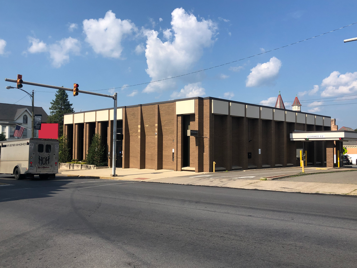
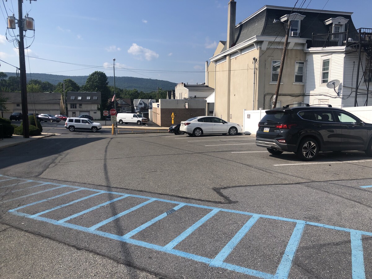
Property Record
535 Main St, Slatington, PA 18080
NEARBY LISTINGS FOR SALE OR LEASE
Property Detail
535 Main St
556203682840-1
LOTS: 013
Financialbuilding
Lehigh
X
Pennsylvania
42095C0088E
13
2024
0.26 AC
2024
Lehigh Valley
005200
Philadelphia
5,460 SF
Allentown-Bethlehem-Easton, PA-NJ
DEMOGRAPHICS near 535 Main St
1 Mile
3 Mile
5 Mile
2024 Total Population
6,060
13,857
35,186
2029 Population
6,114
13,984
35,408
Pop Growth 2024-2029
+ 0.89%
+ 0.92%
+ 0.63%
Average Age
41
43
43
2024 Total Households
2,521
5,735
14,236
HH Growth 2024-2029
+ 0.87%
+ 0.91%
+ 0.65%
Median Household Inc
$51,428
$65,384
$71,795
Avg Household Size
2.40
2.40
2.40
2024 Avg HH Vehicles
2.00
2.00
2.00
Median Home Value
$189,176
$213,720
$234,386
Median Year Built
1949
1969
1972
Nearby Places
- Restaurants
- Banks
- Shops
- Fitness
- Groceries
PUBLIC TRANSPORTATION
AIRPORT
Lehigh Valley International
DRIVE
WALK
Distance
Lehigh Valley International
27 min
16.1 mi
Freight Ports
Port of Philadelphia
DRIVE
WALK
Distance
Port of Philadelphia
93 min
70.4 mi
SALE & LEASE HISTORY
LISTING DATE
SALE/LEASE

Oct 17, 2023
For Sale
Aug 10, 2022
For Sale
Nearby Properties
Address
Land Use
TOTAL SIZE
Lot Size
Zoning
Address
Land Use
TOTAL SIZE
Lot Size
Zoning
101,962 SF
28.02 AC
SR
Address
Land Use
TOTAL SIZE
Lot Size
Zoning
112,243 SF
18 AC
SR
Address
Land Use
TOTAL SIZE
Lot Size
Zoning
71,582 SF
11.90 AC
RR
Address
Land Use
TOTAL SIZE
Lot Size
Zoning
61,636 SF
2.70 AC
TR
Address
Land Use
TOTAL SIZE
Lot Size
Zoning
784.80 AC
BM
Address
Land Use
TOTAL SIZE
Lot Size
Zoning
379.18 AC
BM
Address
Land Use
TOTAL SIZE
Lot Size
Zoning
25,767 SF
0.39 AC
TC
Address
Land Use
TOTAL SIZE
Lot Size
Zoning
17,636 SF
2.51 AC
SR
Address
Land Use
TOTAL SIZE
Lot Size
Zoning
7,396 SF
175.58 AC
BM
Address
Land Use
TOTAL SIZE
Lot Size
Zoning
15,655 SF
11.32 AC
BM
Address
Land Use
TOTAL SIZE
Lot Size
Zoning
11,029 SF
4.79 AC
TR
Address
Land Use
TOTAL SIZE
Lot Size
Zoning
235,207 SF
11.34 AC
I
Address
Land Use
TOTAL SIZE
Lot Size
Zoning
5,534 SF
181.51 AC
BM
Address
Land Use
TOTAL SIZE
Lot Size
Zoning
12,192 SF
0.24 AC
TR
Address
Land Use
TOTAL SIZE
Lot Size
Zoning
118,072 SF
12.69 AC
R40
Address
Land Use
TOTAL SIZE
Lot Size
Zoning
15,589 SF
15.86 AC
GI
Address
Land Use
TOTAL SIZE
Lot Size
Zoning
9,220 SF
1.95 AC
RR
Address
Land Use
TOTAL SIZE
Lot Size
Zoning
17,043 SF
0.26 AC
TR
Address
Land Use
TOTAL SIZE
Lot Size
Zoning
9,037 SF
7.88 AC
R
Address
Land Use
TOTAL SIZE
Lot Size
Zoning
9,840 SF
3.26 AC
RR
Address
Land Use
TOTAL SIZE
Lot Size
Zoning
8,774 SF
3.05 AC
C
Address
Land Use
TOTAL SIZE
Lot Size
Zoning
3,584 SF
0.52 AC
C
Address
Land Use
TOTAL SIZE
Lot Size
Zoning
8,523 SF
1.99 AC
RR
Address
Land Use
TOTAL SIZE
Lot Size
Zoning
3,751 SF
56.46 AC
I
Address
Land Use
TOTAL SIZE
Lot Size
Zoning
12,803 SF
0.93 AC
TR
Address
Land Use
TOTAL SIZE
Lot Size
Zoning
7,968 SF
0.40 AC
TR
Address
Land Use
TOTAL SIZE
Lot Size
Zoning
56,250 SF
5.36 AC
C
Address
Land Use
TOTAL SIZE
Lot Size
Zoning
7,104 SF
3.18 AC
TR
Address
Land Use
TOTAL SIZE
Lot Size
Zoning
132.20 AC
BM
The World's #1 Commercial Real Estate Marketplace
Connect with us
© 2025 CoStar Group
The information above has been obtained from sources believed reliable. While we do not doubt its accuracy we have not verified it and make no guarantee, warranty or representation about it. It is your responsibility to independently confirm its accuracy and completeness. Any projections, opinions, assumptions, or estimates used are for example only and do not represent the current or future performance of the property. The value of this transaction to you depends on tax and other factors which should be evaluated by your tax, financial, and legal advisors. You and your advisors should conduct a careful, independent investigation of the property to determine to your satisfaction the suitability of the property for your needs.